 Catalogue PIGMA
D3: Commercially Exploited Species
Type of resources
Available actions
Topics
Keywords
Contact for the resource
Provided by
Formats
Representation types
Update frequencies
status
Scale
-
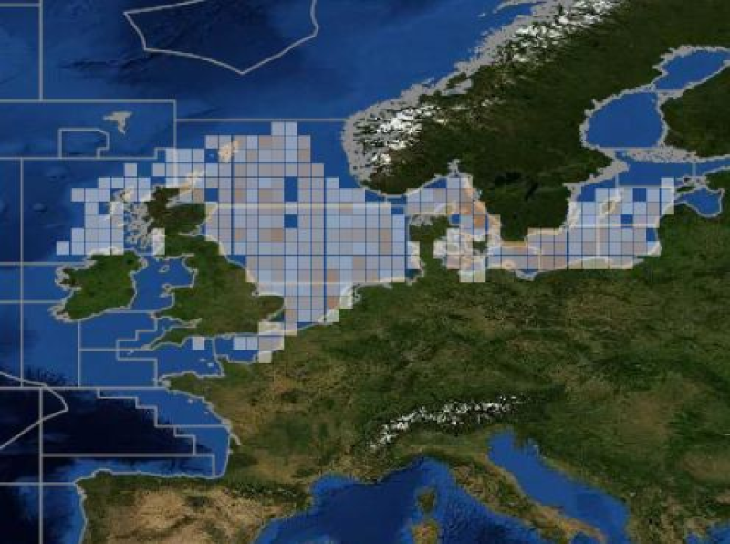
ICES database of trawl surveys
-
-
-
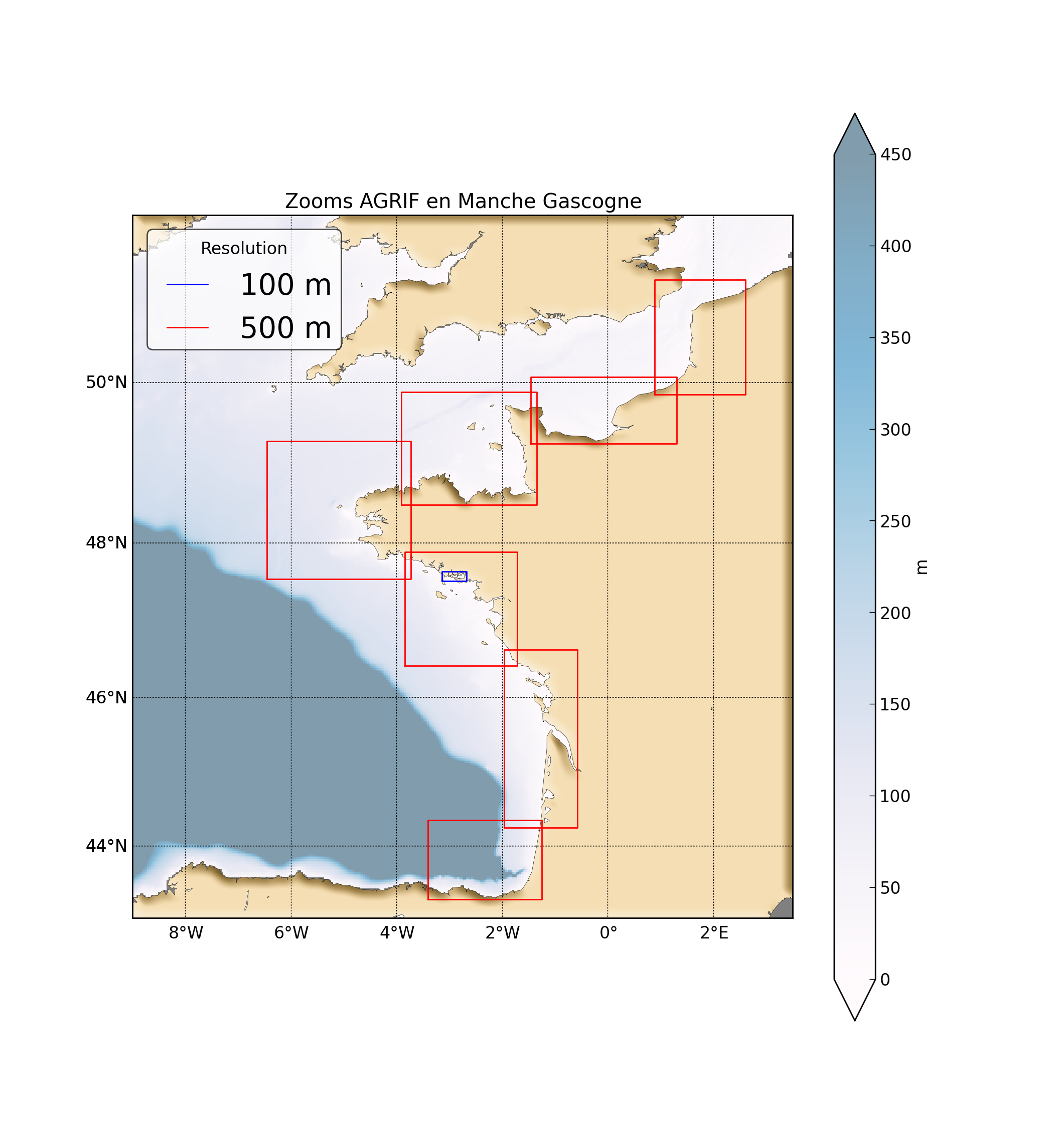
"Abstract: " Hydrodynamic database build with the MARS3D model along the french manche and atlantic coast at high spatial (500m) and temporal (1h) resolution "Details:" Seabed habitats maps are build from statistics models which need some data that describe the physical environment of the different species. Theses environmental factors are the salinity, temperature and shear stress (from waves and current) on the sea floor. Statistics are based on realistic and inter-annual simulations from 3D ocean models.Models output are currently available at a uniform resolution of 2.5 km along the whole French coast,as a part of the PREVIMER project (http://www.previmer.org) To increase the horizontal resolution of the model to 500m grid spacing, an on-line grid refinement technique has been carried out with the AGRIF library. (http://www-ljk.imag.fr/MOISE/AGRIF/) Seven zooms (with 500m resolution) have been implemented in the 2.5 km MANGAE configuration. From this configuration, an hindcast of six years (from 2010 to 2015) has been simulated and cover the french coast from spain to pas-de-calais area : "Main features of the hindcast" Horizontal resolution : 500m Vertical resolution : 40 sigma levels Temporal resolution : 1 Hour "Available physical parameters" ◦ 2D : Sea surface height and barotropic velocities (U and V components) ◦ 3D : Temperature, Salinity and baroclinic velocities
-
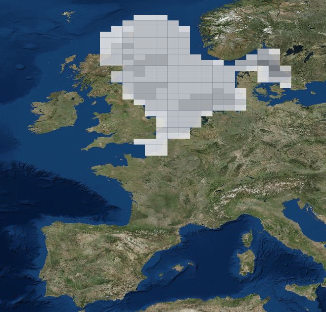
DATRAS North Sea Bottom Trawl Survey
-
-
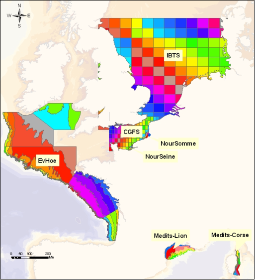
The dataset includes age- and length-based catch per unit effort data for commercial fish species collected by the French trawl survey EVHOE.
-
-
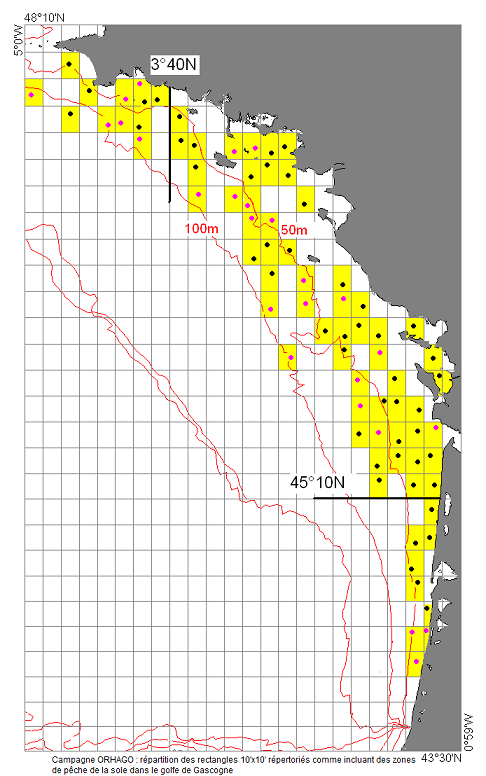
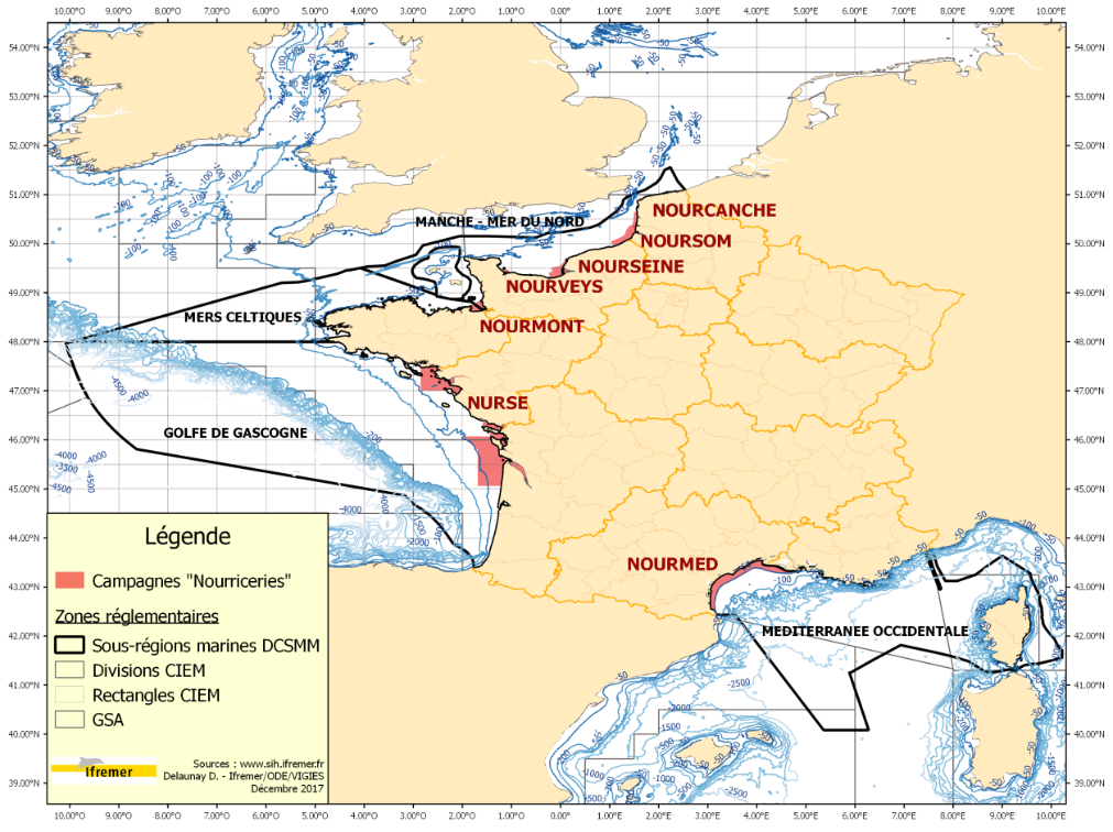
The ORHAGO cruises (Observation of the benthic aquatic resources of the GOlfe de Gascogne) are part of Ifremer's mission of observation and expertise in support of fisheries management. Their main aim is to obtain series of abundance indices for flatfish and in particular for sole. Consequently, the choice was made to adopt a beam trawl to comply with the standards of the International Council for the Exploration of the Sea (ICES) for flatfish. This choice has made it possible to be part of the campaigns coordinated by ICES and thus to be a member of a community in which the methodology and results can be discussed each year in the ICES WGBEAM working groups. Since 2013, the ORHAGO campaigns have been used to assess the state of the Bay of Biscay sole stock. They allow this assessment to be carried out analytically, i.e. using a model to analyse and simulate the dynamics of the stock. The ORHAGO campaigns are also a source of information on the evolution of benthic populations and coastal benthic habitats in the Bay of Biscay.
-

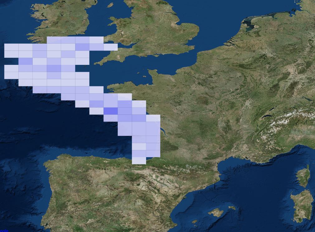
ICES database of trawl surveys